Products and services that work together
We build, operate, and license location services for enterprises. Our offerings are interconnected - a single customer relationship can span custom solutions, API products, AI integration, and platform licensing.
Engineered and deployed on your behalf
We integrate your location data onto our platform and deliver services your business depends on. These aren't off-the-shelf - they're configured to your data, your systems, and your requirements.
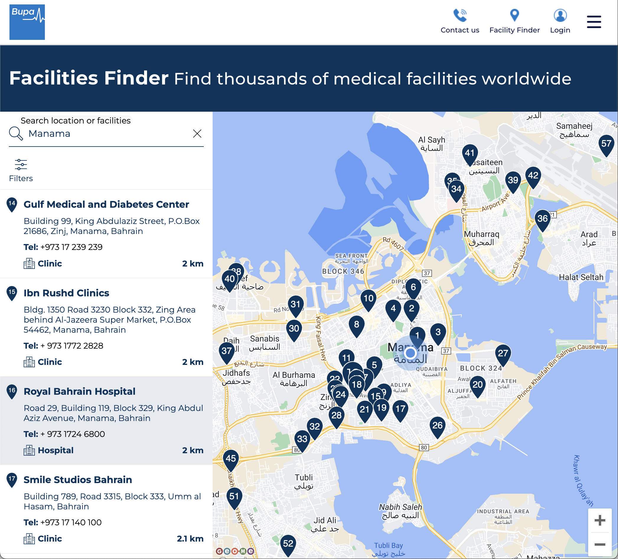
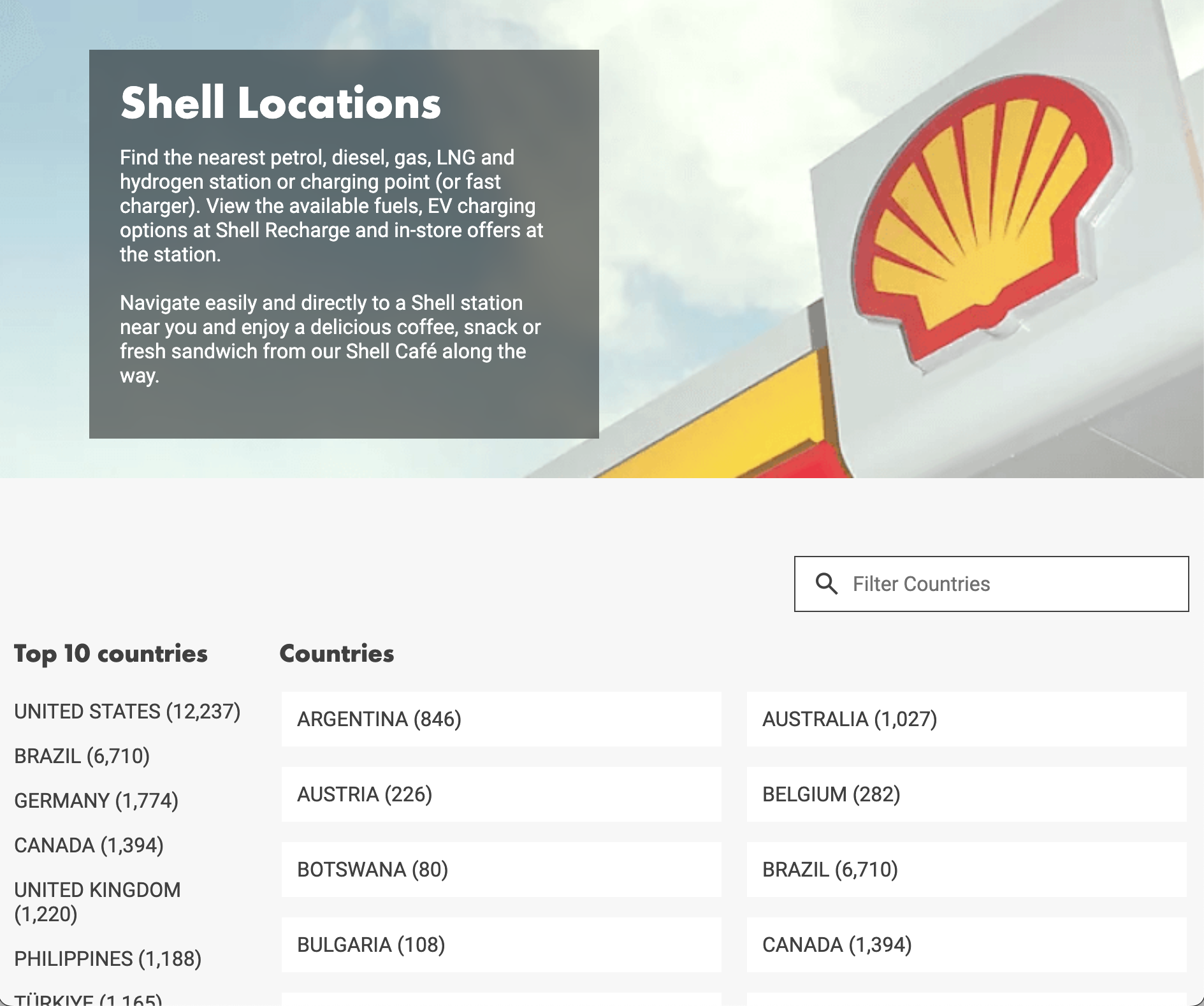
Location Finders
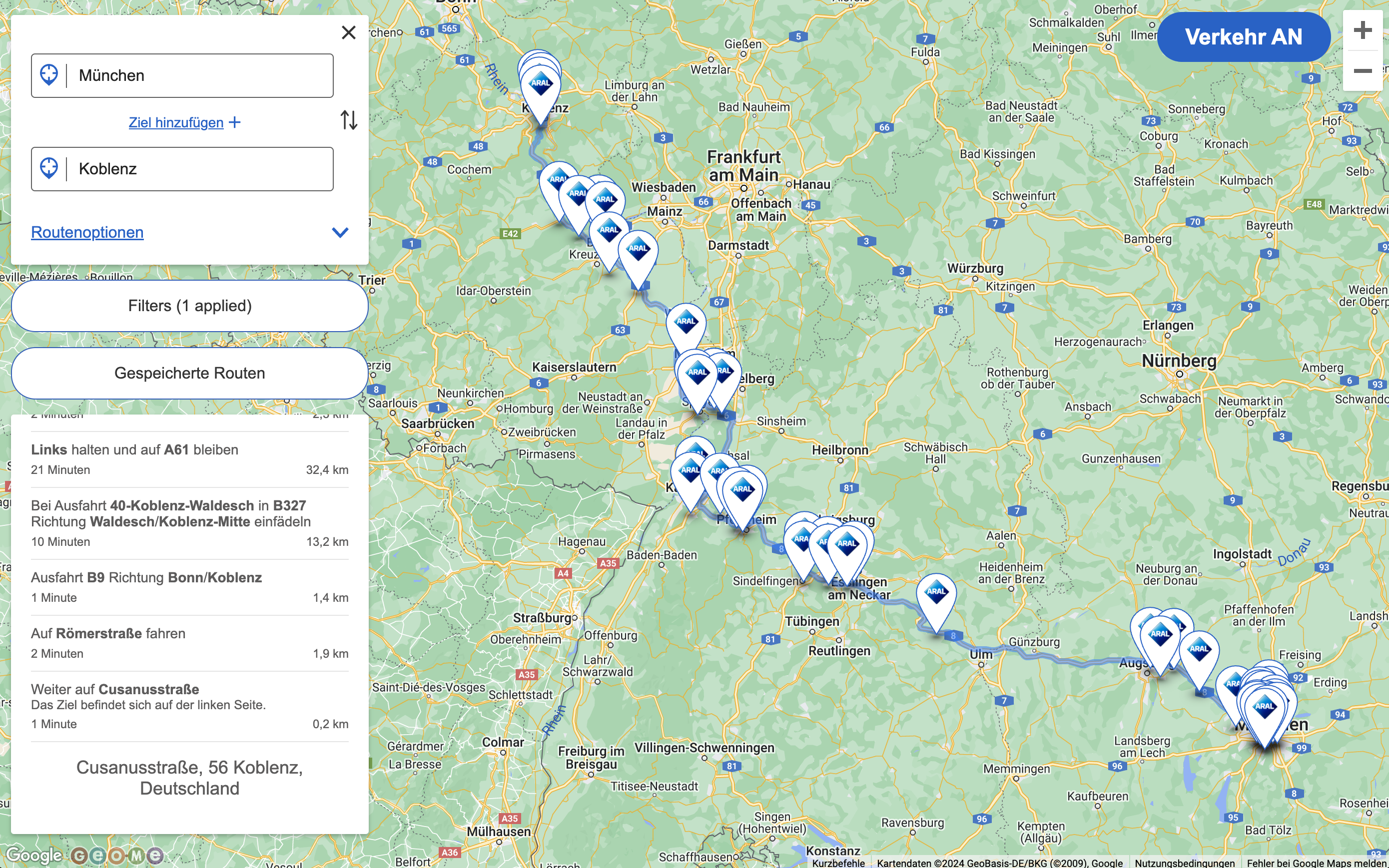
Location finders for retail, energy, healthcare, and service businesses. Customers find and learn about locations - stations, branches, facilities. These serve millions of daily users worldwide across multiple markets and languages.
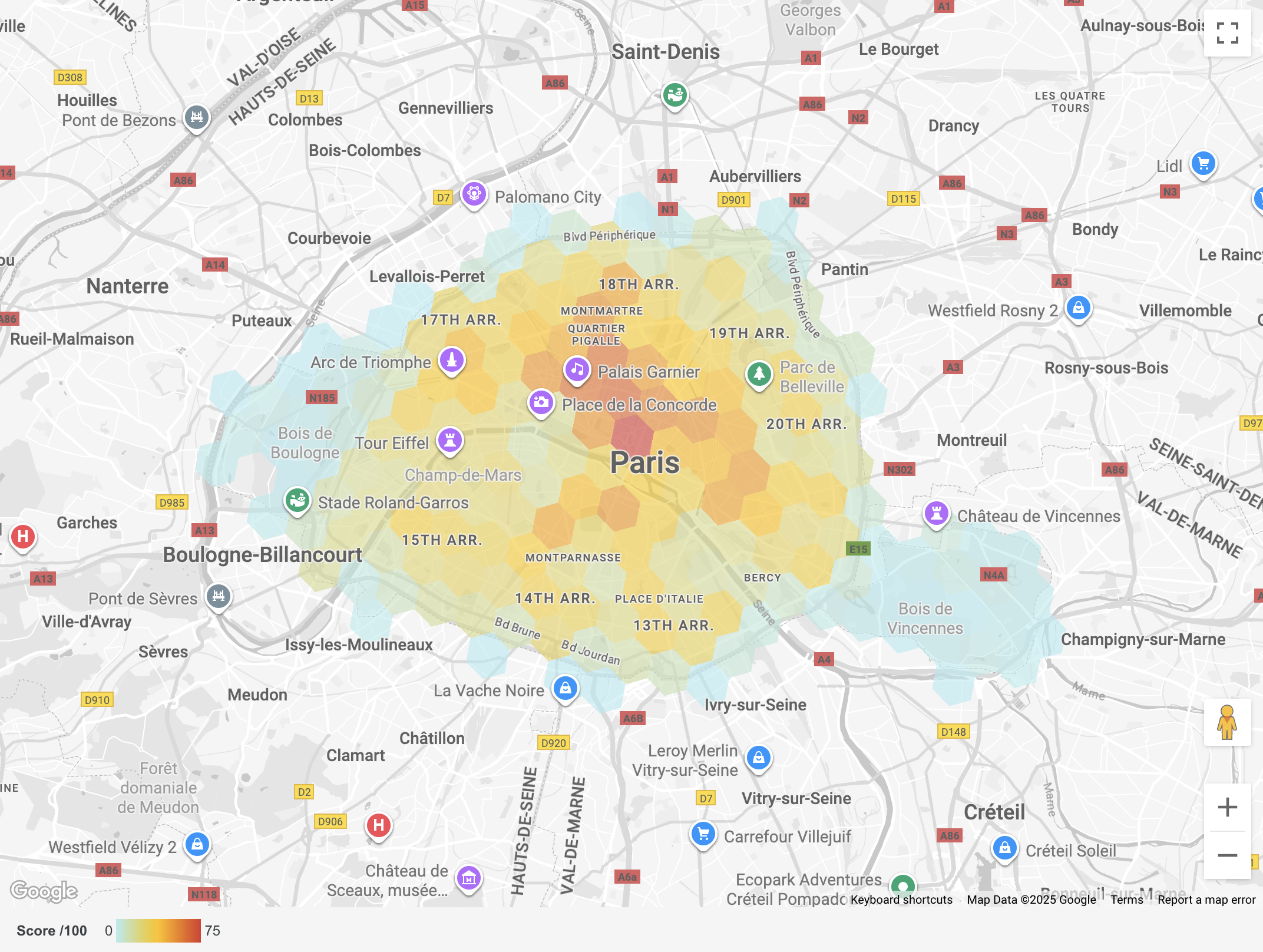
Location Intelligence
Private applications for internal data - insurance portfolio visualisation, customer analytics, operational dashboards. Interactive maps that make large-scale location data useful.
Location SEO Pages
Search-optimised pages for each physical location. These capture organic search traffic, provide locally relevant information, and include structured data markup. WCAG accessible and compliant.
Your APIs. Our Platform.
Your data, exposed through your own branded APIs and powered by our location platform. Partners, apps, and internal systems query your locations without knowing we're behind the service - from integration with navigation platforms to powering third-party applications.
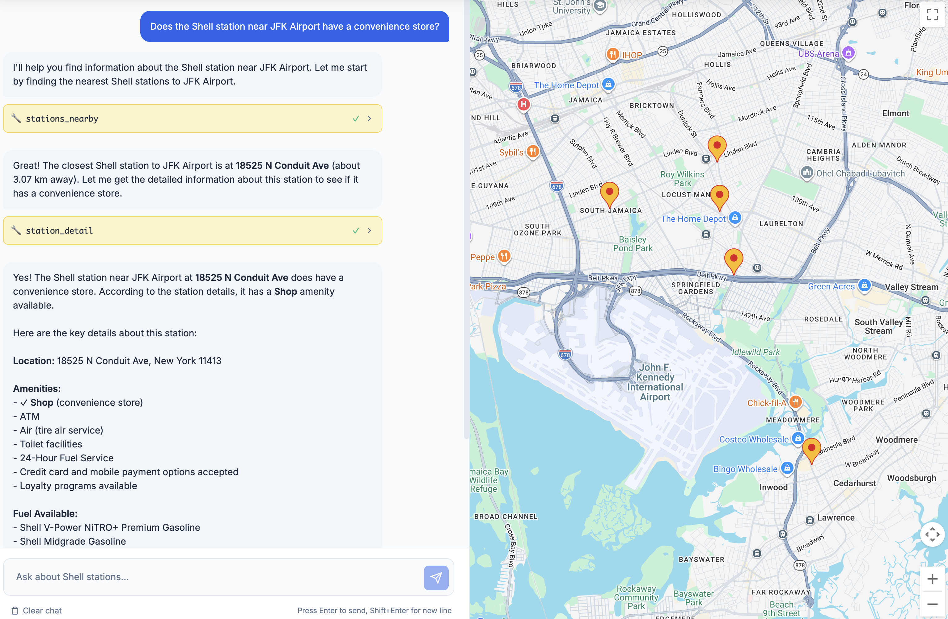
Built for AI Consumption
From location finders to routing and data services, everything we build is API-first and MCP-enabled - structured for direct consumption by AI agents and automation platforms. When an AI system needs to find locations, calculate routes, or check real-time availability, our software is ready to answer.
Master Data & Configuration
Administration tools for creating, updating, and managing location records. A single source of truth ensuring data across finders and SEO pages stays consistent. Our Configuration Hub enables business teams to manage filters, translations, and display rules across markets in real time - without engineering involvement.
Fast provisioning of enterprise-grade geospatial APIs
The Geo.me API Platform delivers building-block and composite APIs that customers integrate directly into their workflows. No prior data integration required.
Building Block APIs
Industry-standard geospatial APIs from leading providers:
- Address Management - Autocompletion, search, validation, reverse geocoding
- Place Intelligence - Geocoding, place search, nearby search, photos, time zones
- Environment - Weather, air quality, pollen, solar data
- Routing - Advanced routing (truck, toll, EV, eco-friendly), distance calculations, route optimisation, catchment areas
Composite APIs
Tailored APIs that blend multiple building blocks with business logic - dynamic provider selection, multi-step workflows, response transformation, and enhanced validation.
Platform Features
Access control with per-key quotas. Observability through dashboards and alerting. Caching where permitted for latency and cost reduction. A management portal for credential lifecycle.
Making every capability available to AI
MCP Servers sit on top of the API Platform, making every building block and customer data source available to AI agents through a single endpoint.
This is where our two named products connect. The API Platform provides the geospatial capabilities. MCP Servers expose those capabilities - plus customer-specific data, business logic, and real-time feeds - to any AI system that speaks the MCP standard.
The result: an AI assistant can geocode an address, find nearby locations, calculate drive times, check real-time availability, and return a structured answer - all through one connection. No custom integration. No code changes when capabilities expand.
Learn more about AI & LocationGoogle Maps Platform at enterprise rates
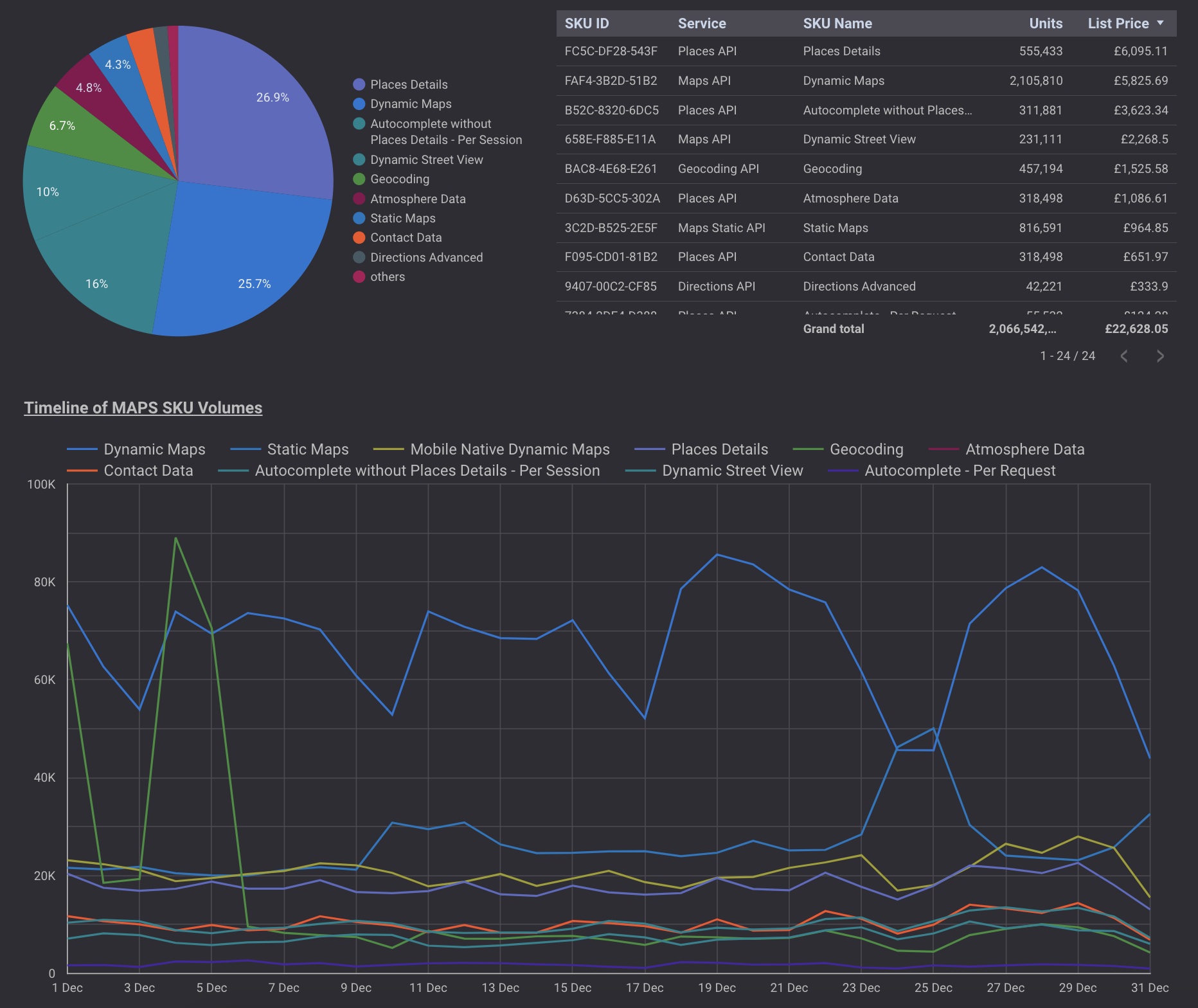
As a Google Cloud Premier Partner since 2009, we help enterprises access Google Maps Platform with significant cost efficiencies. Our expertise translates platform complexity into concrete savings - volume discounts that grow with your usage.
We provide optimisation consulting, live consumption dashboards, configurable alerts, and strategic account management - not just a billing arrangement.
Learn more about Google Maps PlatformBuilt and operating today
Let's talk about
what you need
Tell us what you're working on. We'll explore how our deep domain expertise can help.
Start a conversation