

Roads. A digital twin for your network, without a sensor in sight.
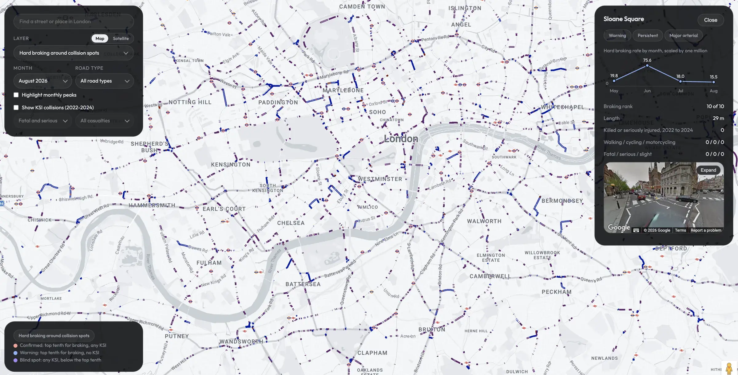
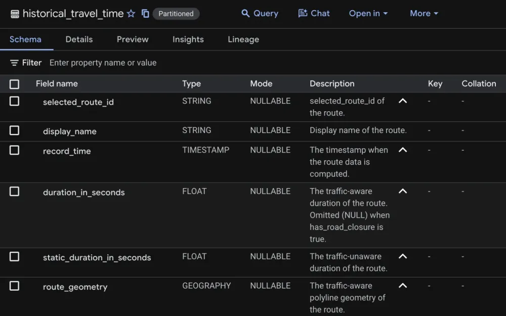
We model your road network from Google’s traffic data: every segment, local roads included, with speeds, journey times, vehicle counts and disruptions. It lands in your own BigQuery data resource, with nothing to install at the roadside.
The platform. Every road segment, modelled from Google’s data.
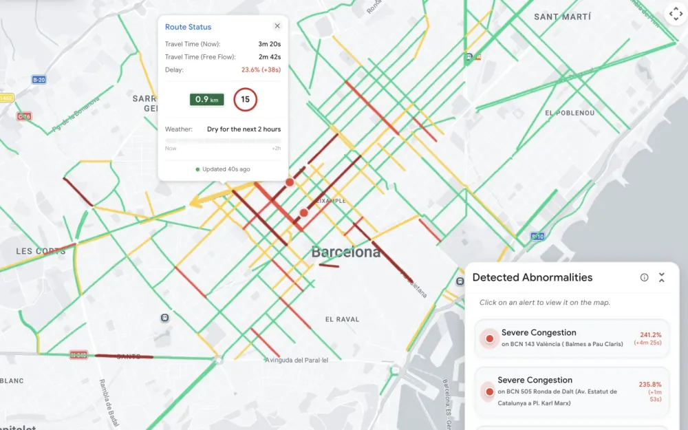
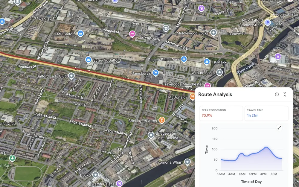
Journey times and speeds
Google’s Roads Management Insights gives travel time by hour and day along any corridor you choose, with speeds refreshed every few minutes.
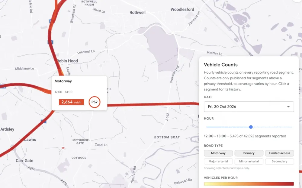
Vehicle counts
Estimated volumes by road, so you can compare busy and quiet roads fairly.
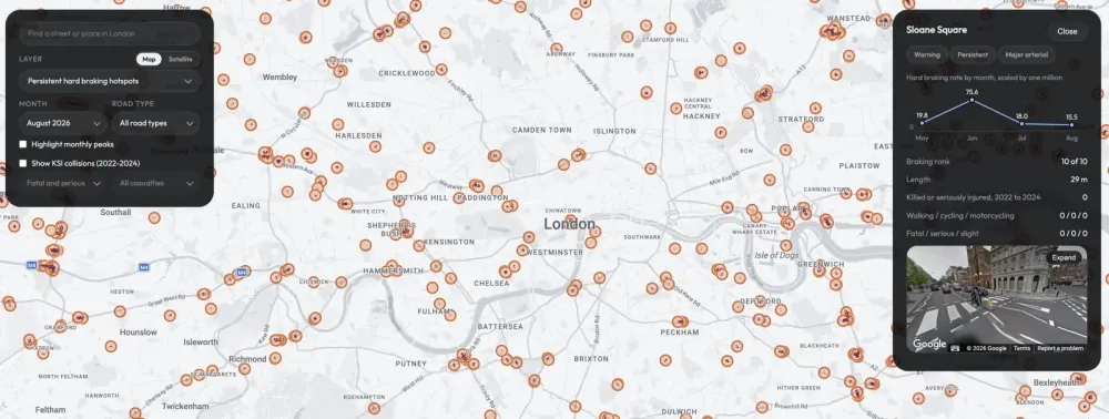
Hard braking
Where drivers brake hardest, relative to the distance driven. A leading indicator for road safety.
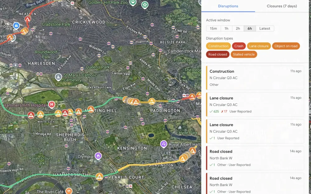
Disruptions
Incidents, closures and roadworks as Google sees them, alongside your own works programme.
Road safety. Find the hidden danger before it reveals itself.
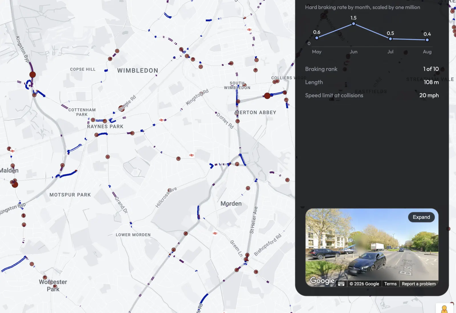
Hard braking shows where the near misses are. We rank every road segment in a network by hard braking per kilometre driven, following a method published by Google Research, using plain arithmetic anyone can check.
Each one links to Street View, so an engineer can look at the junction or the crossing before anyone goes out to site. The judgement about what to change, and in what order, stays with your team.
What we build. Answers on congestion, safety and where to invest.
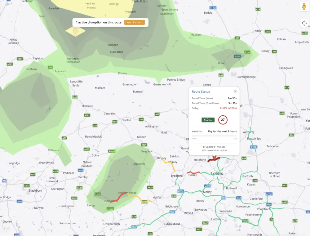
Network operations
Speeds, closures and roadworks across a city, updated as they change.
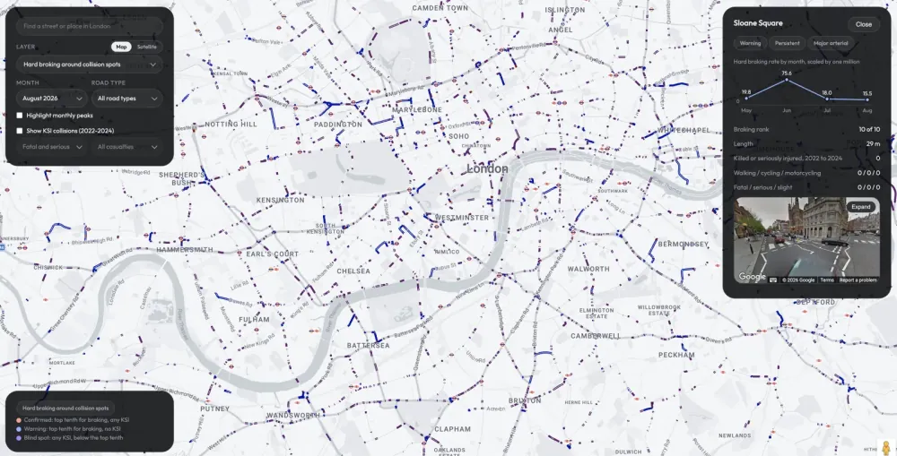
Safety rankings
Every segment ranked, with the evidence attached, ready for your engineers.
Planning and investment
Journey times and volumes over time, to show where a scheme would do most.
Set up in your cloud
Datasets, permissions, regions and cost controls configured properly in your own Google Cloud project.